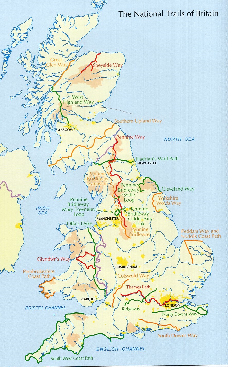
Thames Path, Walking the | wandelgids
National Trail from London to the river’s source in Gloucestershire


€23,50
direct leverbaar!
- Zeer ruim assortiment
- Verzending 1-2 werkdagen
- Niet tevreden, geld terug
- Ruilen binnen 14 dagen
A guidebook to walking the Thames Path, a National Trail covering 182 miles between the Woolwich Foot Tunnel and the river's source in Gloucestershire, passing through Windsor, Oxford and rural countryside. Provides full information for this easy riverside route that takes around two weeks to complete. Includes a 1:25K OS map booklet.
Seasons
the best seasons for walking are Spring and Autumn, although the summer has longer days. The Thames is a living and ever changing green waterway so in winter there can be flooding.
Centres
Greenwich, Central London, Richmond, Runnymede, Henley, Reading, Wallingford, Dorchester-on-Thames, Abingdon, Oxford, Lechlade and Cricklade
Difficulty
the route is described in 20 sections between 4 and 16 miles in length. Most of the walk can be undertaken close to public transport, mainly in the form of rail. But beyond Oxford the path can begin to feel remote and there is no railway station until the source. Here it is best to book accommodation ahead. This is a flat walk with just one hill (rewarded with a view). There are no stiles but many kissing gates and various path surfaces.
Must See
the famous landmarks seen include St Paul's Cathedral, the Palace of Westminster, Windsor Castle and the dreaming spires of Oxford. In addition there are remote churches and pretty waterside pubs. The scenery is ever changing as the walker passes from the urban to rural and below surprise hills as at Goring Gap or the Wittenham Clumps on the Sinodin Hills.
-

 LR-151 Stratford-upon-Avon, Warwick + Banbury | topografische wandelkaartKLIK OP DE SERIENAAM, DAN VERSCHIJNEN ALLE KAARTEN OP VOLGORDE | Deel uit de serie topografische kaadirect leverbaar!€19,90 > alles van Europa
 -

 Birmingham Hidden WalksDiscover hidden gems around Birmingham with 20 walking routes. Featuring 20 walks in and around thedirect leverbaar!€12,50 > alles van Europa
 -

 LR-118 Stoke-on-Trent + Macclesfield | topografische wandelkaartKLIK OP DE SERIENAAM, DAN VERSCHIJNEN ALLE KAARTEN OP VOLGORDE | Deel uit de serie topografische kaadirect leverbaar!€19,90 > alles van Europa
 -

 Bradt ShropshireThis new, thoroughly updated second edition of Bradt's Shropshire remains the only full-blown guidebniet direct leverbaar€21,50 > alles van Europa
 -
 LR-153 Bedford, Huntingdon | topografische wandelkaartKLIK OP DE SERIENAAM, DAN VERSCHIJNEN ALLE KAARTEN OP VOLGORDE | Deel uit de serie topografische kaaniet direct leverbaar€19,90 > alles van Europa
 -

 Severn Way, the | wandelgidsWandelgids op handig formaat met een beschrijving van de fraaie Severn Way. Bevat tevens alle praktidirect leverbaar!€17,50 > alles van Europa
 -

 LR-117 Chester, Wrexham, Ellesmere Port | topografische wandelkaartKLIK OP DE SERIENAAM, DAN VERSCHIJNEN ALLE KAARTEN OP VOLGORDE | Deel uit de serie topografische kaaniet direct leverbaar€19,90 > alles van Europa
 -

 EXP-158 Newbury + Hungerford | wandelkaart 1:25.000Deel uit een serie zeer gedetailleerde topografische kaarten (1:25.000), perfect om mee te wandelen.direct leverbaar!€9,00 > alles van Europa
 -

 fietskaart Cotswolds 1:100.000Goldeneye's long established range of Cycling Country Lanes maps were rebranded in 2010 with new phodirect leverbaar!€15,95 > alles van Europa
 -

 Cotswold Way | wandelkaart 1:40.000Gedetailleerde kaart met de wandelroute. Symbolen geven de campings, B&B's, hotels, e.d. aan. In pladirect leverbaar!€25,50 > alles van Europa
 -
 LR-173 Swindon, Devizes | topografische wandelkaartKLIK OP DE SERIENAAM, DAN VERSCHIJNEN ALLE KAARTEN OP VOLGORDE | Deel uit de serie topografische kaadirect leverbaar!€19,90 > alles van Europa
 -

 Thames Path, Walking the | wandelgidsA guidebook to walking the Thames Path, a National Trail covering 182 miles between the Woolwich Foodirect leverbaar!€23,50 > alles van Europa